Flickr geo-tagging
Originally uploaded by Lyndon Wong.
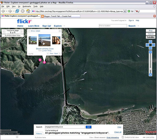
Finally, this weekend I had a chance to try out Flickr’s relatively new geo-tagging feature, using images taken on a recent visit to the Grand Canyon in Arizona. I could zoom-in to specific satellite views of the canyon, and place photos from my trip onto specific segments of hiking trails visible in the satellite map imagery. Despite the high number of photos already available for the Grand Canyon region, I applied the world’s first Flickr geo-tags for photos of the Indian Gardens and Plateau Point, both well-known hiking destinations accessed via the Bright Angel Trail below the South Rim. In a modest sense, I felt the joy of a pioneer :-).
Flickr geo-tagging is a fascinating social media user-experience for both the content tagger and the viewing audience. Andy Laakmann, founder of Webshots, actually discussed a very similar notion around the year 2000. But at that time, sateliite-image enhanced maps were not readily available, nor were the rich browser UI capabilities and mapping mash-up API’s that enable a compelling no-install user experience.
All goes to illustrate that every good idea has a proper place and time. Flickr turned out to be the right place, and August 28, 2006 the right time. For the curious mind, this approach surly beats spinning a plastic globe and flipping through textbooks. Variants of the Flickr geo-tagging experience could be of great value for identifying lodging and dining options, submitted either by the user community or advertisers, preferably an orderly combination of both.
